Eye In The Sky: Startup Gifts Aerial Mapping Tool To Israel At War
Simplex 3D, a startup specializing in highly detailed 3D urban models, played a crucial role during a crisis in Israel. Following a terrorist attack on October 7, which resulted in significant casualties, the company offered its platform for free to the country’s security forces and emergency services. The platform’s exceptional capabilities stem from a proprietary imaging system used in light aircraft to create intricate models of urban areas, initially intended for industrial purposes.
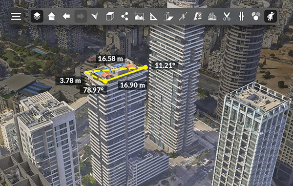
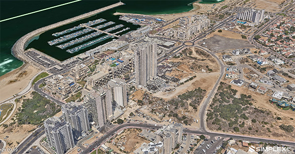
During the emergency, Simplex 3D’s technology proved invaluable. According to CEO Avi Aflalo, their 3D models, offering detail down to three centimeters, were made accessible across Israel for security and rescue operations, surpassing the quality of Google’s models. The platform’s high-resolution imaging is achieved through a unique aerial sweeping technique, capturing extensive data to create the world’s most detailed 3D city models.
The process involves three steps: aerial data collection, processing this data into 3D models using Simplex’s advanced system, and integrating these models into a cloud-based SaaS platform. This accessibility enables users from various devices to utilize the models effectively, whether in the field or remotely. Additionally, the technology was extended for free to southern Israeli communities, aiding in their reconstruction post-attack.
In summary, Simplex 3D’s innovative approach and swift response to a national crisis showcased the practical applications of their technology in emergency response and urban planning, significantly aiding in both rescue efforts and reconstruction processes.
In summary, Simplex 3D exemplifies how technological innovation can transcend its primary industrial use, becoming a vital tool in urban planning, emergency response, and community support.


n all, the company works with more than 100 municipalities worldwide, who use the models for urban planning, data-sharing with the public and even to monitor construction violations.
“Basically they do all of their planning on our systems,” Aflalo says.


